
starting line
BRIEF PROFILE:
Biliran is the oldest town in Biliran Island hence the whole island was named after it. It is located on the southwestern part of the island directly in front of Calubian, Leyte across the Biliran strait.
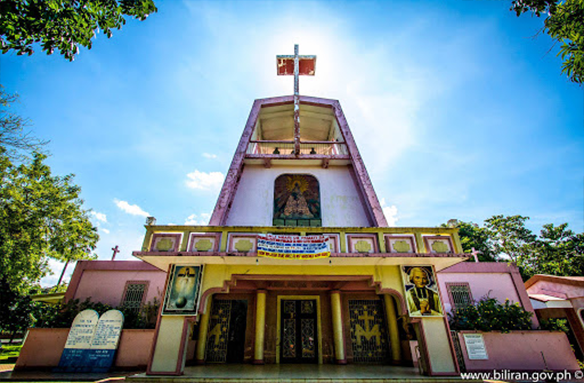
In 1712, Biliran officially became a town, and Capitan Julian Aragon becomes the first leader of the local government in its present site. In 1782 the town became a parish and San Juan Nepomuceno was the patron Saint.
The Development of the Municipality started when the Biliran Bridge was constructed connecting the mainland of Leyte. Transportation facilities in the whole Island has improved. Later on in the early part of 1980’s, the energization of the whole island was realized; thereby the economy of the island province including its municipality has improved.
Formerly, the province of Biliran is part of the province of Leyte, with the passage of a bill creating the sub-province into a regular province in 1992 known as the Local Government Code of 1991 which embodies the Local Autonomy of the Local Government Unit and with the presence of the Internal Revenue Allotment (IRA) of every municipality together with the help of the national agencies, the municipality was able to implement various projects that helps improved the quality of life of every Biliranons.
General Information
Land Area8,630 Hectares
Population (as 2010)16,183 (as of 2010 NSO survey)
Administrative DistrictsEleven (11) Barangays
Population Density1.87 persons/Hectare
IRA AllotmentsIRA (2010) – P 32, 922, 386.00
IRA (2011) – P 35, 561, 076.00
IRA (2012) – P 34, 443, 436.00
IRA (2013) – P 38, 787, 972.00
IRA (2014) – P 43, 988, 072.00
Income Classification5th Class Municipality
Municipal BoundariesNorth : Municipality of Caibiran
South : Mainland of Leyte
East : Carigara Bay
West : Biliran Strait
Major Bodies of WaterBusali River
Moog River
Santol River
Limocnan River
Hamorawon River
List of BarangaysBato
Busali
Burabod
Canila
Julita
Hugpa
Pinangomhan
San Isidro (Poblacion)
San Roque (Poblacion)
Sangalang
Villa EnageSUPPORT SERVICES
ROAD NETWORKConcreteGravel1.National Road17.93 km
2. Provincial Road0.400 km
3. Municipal Road3.874 km
4. Barangay Road18.07 km4.063 km.
ECONOMY
Means of LivelihoodFarming (Primary)
Fishing (Secondary)
Major ProductsRice and Coconut
Other ProductsBanana and Root crops
WATER SUPPLYBiliran Water Supply System
POWER SUPPLYBiliran Electric Cooperative
COMMUNICATION FACILITIESSMART AND GLOBE CELLSITES
TRANSPORTATION FACILITIES(No. per type)
Land2 buses, 2 vans and 8 jeepneys
Water6 motorboats
SOCIAL SECTOR
HEALTH PERSONNELNO. OF PERSONNEL
Doctor1
Nurse1
Midwives4
Medical Technician1
Sanitary Inspector1
Volunteers (BHW)138
Utility Personnel2
Biliran is the oldest town in Biliran Island hence the whole island was named after it. It is located on the southwestern part of the island directly in front of Calubian, Leyte across the Biliran strait.
In 1712, Biliran officially became a town, and Capitan Julian Aragon becomes the first leader of the local government in its present site. In 1782 the town became a parish and San Juan Nepomuceno was the patron Saint.
The Development of the Municipality started when the Biliran Bridge was constructed connecting the mainland of Leyte. Transportation facilities in the whole Island has improved. Later on in the early part of 1980’s, the energization of the whole island was realized; thereby the economy of the island province including its municipality has improved.
Formerly, the province of Biliran is part of the province of Leyte, with the passage of a bill creating the sub-province into a regular province in 1992 known as the Local Government Code of 1991 which embodies the Local Autonomy of the Local Government Unit and with the presence of the Internal Revenue Allotment (IRA) of every municipality together with the help of the national agencies, the municipality was able to implement various projects that helps improved the quality of life of every Biliranons.
General Information
Land Area8,630 Hectares
Population (as 2010)16,183 (as of 2010 NSO survey)
Administrative DistrictsEleven (11) Barangays
Population Density1.87 persons/Hectare
IRA AllotmentsIRA (2010) – P 32, 922, 386.00
IRA (2011) – P 35, 561, 076.00
IRA (2012) – P 34, 443, 436.00
IRA (2013) – P 38, 787, 972.00
IRA (2014) – P 43, 988, 072.00
Income Classification5th Class Municipality
Municipal BoundariesNorth : Municipality of Caibiran
South : Mainland of Leyte
East : Carigara Bay
West : Biliran Strait
Major Bodies of WaterBusali River
Moog River
Santol River
Limocnan River
Hamorawon River
List of BarangaysBato
Busali
Burabod
Canila
Julita
Hugpa
Pinangomhan
San Isidro (Poblacion)
San Roque (Poblacion)
Sangalang
Villa EnageSUPPORT SERVICES
ROAD NETWORKConcreteGravel1.National Road17.93 km
2. Provincial Road0.400 km
3. Municipal Road3.874 km
4. Barangay Road18.07 km4.063 km.
ECONOMY
Means of LivelihoodFarming (Primary)
Fishing (Secondary)
Major ProductsRice and Coconut
Other ProductsBanana and Root crops
WATER SUPPLYBiliran Water Supply System
POWER SUPPLYBiliran Electric Cooperative
COMMUNICATION FACILITIESSMART AND GLOBE CELLSITES
TRANSPORTATION FACILITIES(No. per type)
Land2 buses, 2 vans and 8 jeepneys
Water6 motorboats
SOCIAL SECTOR
HEALTH PERSONNELNO. OF PERSONNEL
Doctor1
Nurse1
Midwives4
Medical Technician1
Sanitary Inspector1
Volunteers (BHW)138
Utility Personnel2
